
Find Who Lives Along Santa Clara Streets
A Santa Clara street directory search works best as a five-link chain. USPS confirms the Santa Clara delivery form. MapSantaClara and the Santa Clara County parcel dataset supply the APN and parcel shape. The Assessor adds assessment evidence without publishing an owner-name web list. The Clerk-Recorder connects the APN to a title instrument. Finally, a Santa Clara voter or historical directory source answers a different question about a person or household.
Keep the Santa Clara street search tied to the exact address. Record the direction, street type, unit, city, ZIP, and APN. If a result gives a permit applicant, contractor, registered agent, or tax mailing addressee, keep that role in the notes. Do not rewrite it as proof of residence.
- Run the address through USPS ZIP Code Lookup, then confirm the parcel in MapSantaClara.
- Copy the APN and situs components from the County parcel layer or Assessor search.
- Use the Assessor address or APN controls for assessment facts and the next title instrument.
- At the Clerk-Recorder, search the grantor and grantee fields, starting with the instrument tied to that APN.
- Use permits, voter rules, and reverse directories only for the specific record role each source documents.
This Santa Clara sequence prevents a common error. A street directory is a map of record paths, not an official household roster.
Santa Clara Street Record Chain
Address-keyed records in Santa Clara come from several custodians. The Santa Clara County parcel layer carries geography. The Assessor carries assessment and roll products. The recorder carries instruments indexed by parties and document facts. The City of Santa Clara carries permits and reports. The state controls voter-file access. A street directory can connect those layers, but each layer has a different meaning.
| Record set | Keeper | Address evidence | Access |
|---|---|---|---|
| Parcel and situs data | Santa Clara County GIS | APN, shape, house number, street, ZIP | Free map or download |
| Assessment search | Santa Clara County Assessor | Address, APN, assessment facts | Free address or APN route |
| Deeds and liens | Santa Clara County Clerk-Recorder | Parties, date, class, legal description | Office index and paid copies |
| Permits | Santa Clara Community Development | Project, dates, contacts, valuation | POP, reports, or request |
| Voter file | California Secretary of State | Controlled voter fields | Self-status or approved request |
The Santa Clara APN is the chief bridge. A street name can change, a parcel can carry several situs addresses, and a tax mailing address can be outside Santa Clara. A legal description identifies the land, while a situs address identifies where the land is located. Those facts should remain separate in a Santa Clara street-by-street worksheet.
Santa Clara Assessor Search Fields
The Santa Clara County Assessor Real Property Search offers Simple Address, Advanced Address, and Search by APN modes. Online owner or assessee names are intentionally suppressed. The Santa Clara portal is still valuable because it can stabilize the parcel identifier that later research needs.
| Field or mode | Required and format notes |
|---|---|
| Simple Address | Property address is required; partial beginning text may work. |
| Street Number | Required in Advanced mode. |
| Street Direction | Optional dropdown; current choices can change. |
| Street Name | Required core name in Advanced mode. |
| Street Type | Separate optional control. |
| Unit | Optional unit or suite. |
| City | Required jurisdiction choice in Advanced mode. |
| APN Number | APN mode accepts eight digits with or without dashes. |
Santa Clara assessment results should be read as parcel evidence. The roll products ordered from the Assessor can contain assessee, billing, value, exemption, and document fields, but the free search does not display every field. This distinction matters when a Santa Clara street directory search seems to produce a blank owner box.
The captured Assessor address application shows the address-first route.
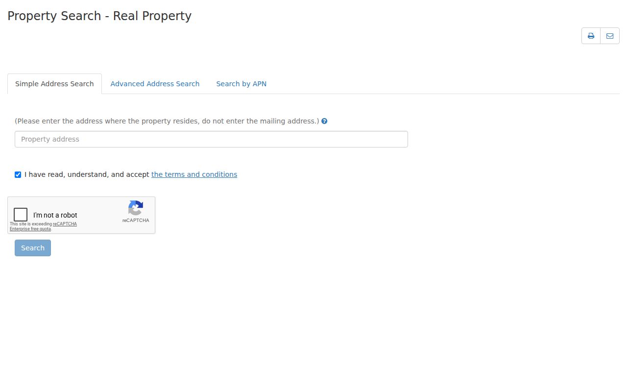
Use the visible address controls to find a parcel, then carry the APN forward rather than trying to force an owner-name search that the public portal does not offer.
SCCMap Parcel Layers for Santa Clara
SCCMap and the Santa Clara County GIS hub provide a visual street browse. Search by street address or APN, select Search for Property, submit, open the results pane, and click the APN. The City of Santa Clara’s MapSantaClara route adds zoning, General Plan, and property-related reports. County parcel open data adds geometry, tax-rate area, situs house number, direction, street type, unit, city, state, ZIP, and the count of situs addresses.
Santa Clara GIS is a geographic source, not a legal survey and not a resident list. It can show the selected polygon and nearby polygons. It cannot reveal occupants. A Santa Clara map is most helpful when the street has an old name, a split parcel, or a house number that no longer matches a directory entry.
The County parcel dataset was captured as the second free browse and export route.
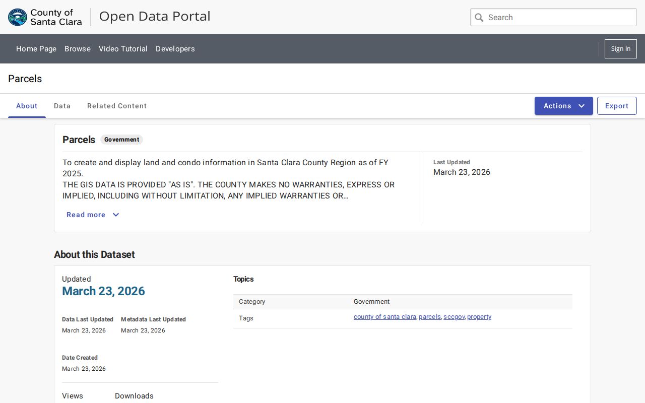
Do not promise a Santa Clara radius export. Static inspection did not confirm an official buffer or measure tool. Select adjoining polygons one by one and record each APN and situs instead.
Situs, Mailing, and Legal Place
Three address concepts shape a Santa Clara street directory. Situs is the physical Santa Clara parcel address. Mailing or billing address is where tax or other notices go. Legal description identifies the land through a recorded description. A mailing address outside Santa Clara can suggest that the listed owner is not local, but it does not prove who occupies the parcel.
- Parcel
- A mapped unit of land identified by an APN and a geometry record.
- Situs address
- The physical location assigned to a parcel or its address components.
- Plat
- A recorded map showing lots, blocks, streets, or survey relationships.
- Criss-cross directory
- An address-first directory section that reverses the usual name-to-address order.
- Legal description
- The recorded land description used in an instrument, which can outlast a street-name change.
Use all three concepts when comparing the Assessor, GIS, and recorder. They answer different questions. This simple separation is one of the best safeguards against turning a property record into a claim about a household.
For a Santa Clara street directory worksheet, place the values in separate columns and retain the source date. That small habit makes later deed, permit, and directory comparisons much easier.
Offline Deeds Along Santa Clara Streets
Santa Clara County real-estate records begin in 1850. The Santa Clara public web index ended on November 5, 2018, so a whole-street deed walk cannot be completed from an open grantor and grantee website. The main Clerk-Recorder office at 110 West Tasman Drive in San José provides public computers, books, microfilm, and Digital Reel. Search document number, date, class, APN, grantor, grantee, or a combined party pair.
Start with the latest Santa Clara title-changing instrument tied to the APN. Read the grantee, grantor, recording date, document class, and legal description. Search the grantor as an earlier grantee. This traces ownership backward, but it does not reveal every prior occupant. Instrument images are available at the office. Copies cost $4 for the first page, $2 for each additional page, and $2 for certification.
The Santa Clara recorder’s research and purchasing details explain the 1850 to 1980 Digital Reel split and the 1981 to present workstation route. The index has roles, not a complete resident directory.
Santa Clara Permit Evidence by Address
Santa Clara’s Permitting Online Portal, or POP, runs around the clock for public permit lookup, inspection scheduling, revisions, fees, and service requests. The public portion can connect an address to a project, applicant, property owner, contractor, project description, issue or status date, inspection, and valuation. A named contact remains a documented Santa Clara project role.
The City of Santa Clara also publishes monthly and annual permits-issued spreadsheets. The live page lists monthly workbooks for 2024 through 2026 and a full-year 2023 workbook. Download a relevant period and filter the address column when POP does not support street browse. Santa Clara plans can be restricted by copyright or safety rules.
The Santa Clara Permit Center lists the portal and its contact route. A focused city request can fill an older or missing period.
Requesting Santa Clara Permit Records
The Santa Clara Permit Center combines Building, Planning, Public Works, and Fire counters. Its listed telephone is 408-615-2420. POP is available for public lookup, while scheduling an inspection or taking certain actions requires a linked account. When a Santa Clara street search needs an older project or a report field that is not exposed, ask the city for an existing permit record or spreadsheet.
Santa Clara’s non-police public-records route accepts requests through NextRequest, by telephone to the City Clerk at 408-615-2220, or in person. Electronic production is free when possible. Paper copies are $0.10 per page plus postage, and inspection is free. Identify the address, permit number, department, and inclusive dates so Santa Clara staff can locate a narrow record without turning a permit request into an identity question.
Santa Clara plans and other materials may be restricted by copyright, safety, or another exemption. A record that names an applicant or contractor still describes that project role only.
Renamed Santa Clara Streets
Address research in Santa Clara has a history problem. Santa Clara planning material records changes such as San Francisco Street to French, Almado to Benton, Moultrey to Fremont, Orchard to Spanish, French to Grant, and Spanish to Sherman. The city grid changed extensively after 1866, and El Camino was realigned in 1982.
An inventory record at 1072 Alviso notes a former Santa Clara address of 3100 The Alameda. A directory search that uses only the modern name can miss the older entry. Search both names and numbers, then match the legal lot, APN, plat, or map. The 1847 Old Quad grid and later north and west Santa Clara subdivisions also represent different development eras.
Santa Clara street names that honor mayors, developers, priests, or pioneers are useful address clues. They are not proof that a person with the same surname lived there.
Criss-Cross Santa Clara Directory Years
The historical reverse route begins with a Santa Clara street. San José Public Library says Santa Clara surname-plus-street access starts in 1913. History San José dates reverse indexing to 1914. Both points should remain in a research note because the institutions may be describing different holdings or definitions.
Santa Clara issues are verified in the California Room for 1915 to 1919 and 1922 to 1937. Earlier city directories from 1870 through 1979 are primarily name-first, though later Haines and Pacific Bell reverse books continue address work after printed city directories end. A Santa Clara volume’s abbreviation key should be photographed or transcribed before reading entries.
The complete historical collection is handled by the Santa Clara city directory shelf. This Santa Clara street directory uses it only for the address-to-occupant part of the chain.
Santa Clara Voter File Boundaries
California’s public My Voter Status tool is a Santa Clara voter’s self-lookup. A full Santa Clara voter file can be released only to approved applicants for approved purposes, with an application, identification, fee, security plan, and signed certifications. The file can include residence, mailing, party, status, precinct, district, and participation fields, but not ballot choices. Protected voters and confidential records are withheld.
There is no commercial street browse for Santa Clara voters. Do not treat a Santa Clara voter-file rule as a general permission to assemble a Santa Clara street directory. For a personal status question, use the voter’s own state lookup. For an authorized Santa Clara research question, follow the Secretary of State’s file-request rules and keep the permitted use narrow.
What a Santa Clara Street Directory Misses
A Santa Clara street directory cannot show every Santa Clara household member, renter, guest, utility customer, delivery recipient, or person who keeps an address private. Santa Clara DMV information is restricted by the federal DPPA and state law. A Santa Clara deed, Santa Clara tax mailing address, Santa Clara permit applicant, Santa Clara registered agent, or neighboring parcel owner has a record role that should not be stretched into current residence.
Lawful use. Santa Clara address research is appropriate for house history, family history, civic curiosity, reconnection, and personal safety awareness. Using records to stalk, harass, intimidate, or harm another person is prohibited and can violate California law.
When the goal shifts from a whole Santa Clara street to one named person, a separate Santa Clara resident lookup keeps the identity-resolution rules in view. It is safer to stop when the Santa Clara sources disagree than to fill a Santa Clara gap with a guess.